It was perhaps one year ago when me and a friend of mine got the idea of traveling to Nepal. We wanted to hike the Annapurna Circuit, one of the world's most famous trekking routes. It was fairly difficult to find information in advance though, which is why I'm writing this. Maybe our experience will help somebody else to plan their trip to this beautiful country.
All the pictures on this blog post are taken during our first week, because my camera gave up after that. Perhaps some day I can update this post with some pictures from a friend of mine.
 It turned out the Annapurna Circuit is not marked in any way in the beginning. The locals, however, obviously know the route and always pointed us the right way, if we looked puzzled at all. It got very hot in the late morning already. I had no idea of the accurate temperature, but my best guess was something between 24 and 30 degrees Celsius. I don't handle heat very well and the worry of it being this hot for the whole trip managed to kill a little bit of my excitement of finally hitting the trail. Because of the heat and some stomach problems we decided to spend the night in Ngadi, even though we arrived only just after midday. A cold shower felt extremely good and I felt stupid not having brought soap with me for washing clothes (I would highly recommend bringing an all-natural soap with no chemicals that are harming the environment, since all the dirt water just goes straight to the ground or in a river). In the evening I started getting nauseous, lost my appetite and got a headache, which must have been because of the sudden exposure of such strong sunlight and not wearing a hat. Again, a point of learning.

 We saw quite a lot of trekkers - well, lot for us used to seeing nobody when hiking in the Finnish fells and forests - and were quite surprised about how few of them carried their gear themselves. Most of them had porters which I don't think is a bad thing in itself, but we saw men having to carry regular suitcases on their backs. These luggages would sometimes weigh up to 40 or 50 kilos, way over half of the bodyweight of their carriers. I couldn't help but consider these trekkers selfish. What on earth are they packing with them anyway? Our rucksacks weighed around eight kilos and I didn't even end up needing all the clothes I was carrying with me.
 The track, which is not just a hiking path but a passageway of the locals, follows the hillsides and weaves through the narrow alleys of the villages. Sometimes it's taken over by water, sometimes covered up by a landslide. I had expected to see more erosion. Maybe because everything grows so quickly, nature has still been able to recover from all the wearing.
 My feet were so stiff in the morning. It takes time for the body to get used to this. We started walking already at six a.m., but sun still seemed to reach us early today. The road had narrowed into a path and we got our first (and fortunately the last) encounter with leeches. Maybe those are the reason we were advised to wear long pants.
 We were tired when arriving to Tal and decided to stay there instead of following our original plan and walking for seven more kilometers to Dharpur. This was the first point with a working Wi-Fi since we left Kathmandu. We had remarked that the locals had running water coming from water streams up the hills and decided that whatever the locals found good enough to drink, we would too. We only bought bottled water in Kathmandu and Pokhara, but everywhere else we filled up our water bottles from outside taps or people's kitchens and for us that worked out just fine.
 While having breakfast we saw the guy that had been following us yesterday picking up his baggage and continuing his journey. We had totally just been paranoid. Walking felt easy for me today and my sunburns were not that painful anymore.
 We had to wait for the third one to return from Besishahar until 2 p.m. Her trip had been horrible. Yesterday the jeep had been full of drunken men, including the driver, that had kept throwing up along the way. She had had to go through three banks until she found one with actual money, in which too the amount for withdrawal was too small. The hotels were full due to a local festival and on her way back they had almost been caught up in a landslide. Now the group was safely back together anyway and we could continue our journey to the next village, Danakyu.

 We were following the road almost all the way from Danakyu to Chame. The air was starting to get a bit more dry and it wasn't quite as hot anymore. Or maybe I just got adjusted, who knows. Our hotel in Chame was nice, just like the ones before, except in this one we had a group of noisy Israelis keeping everybody awake. I think by this point we had also realized no matter if the hotels advertised a hot shower, there most likely wouldn't be one. Another thing we never forgot was to check the beds for bedbugs! The locals often use a straw mat underneath the mattresses, which the bedbugs seem to especially like. We saw some in a couple of places, after which we were really careful with that matter.

 I noticed I began getting out of breath more quickly than usual, but walking felt good. We saw glimpses of the highest peaks around us. The views had changed from day to day but this was when the changes got bigger and bigger. Or that was how it seemed.

 Leaving Upper Pisang we got to some serious uphills. The sun was doing it's best roasting us again and my heels got blisters in them. We reached the town of Ngawa, which had a somehow weird atmosphere and unlike most people, we didn't realize to follow the road but stuck with the marked path. We found ourselves in a steep downhill and our muscles felt very tired, shaking as we worked our way to the bottom. We decided to stay the night in the village we saw below, but as we got there, we found out it was abandoned. We sat down for a break with a group of young Nepalese men and walked the rest of the way to Mungji together with them.
 The closer we got to Thorong La, the more tourists we saw. Many rode a jeep to Manang and started their hikes there. What bothered me was how many people wore clothes considered too revealing by the locals. It's preferred to wear long pants or at least 3/4 length and have your top covered. I don't know whether these people didn't know or didn't care but whatever the case, I think it's disrespectful to not follow the unwritten rules of the local culture.
 We had decided to do a day trip and visit the Milarepa's Cave and got accompanied by the Nepalese fellows and a Californian guy. The hike up was steeper than we expected. We didn't have any water with us, which I found extremely stupid and worried about. There was a stream of water along the way, though, fortunately.
 I woke up with my head filled with snot, a sore throat and aching muscles. I was happy we hadn't been planning for a very long walk for today. Somewhere between Braka and Manang we met our Californian friend who was on his way to the Ice Lake. One of my friends decided to go with him, where as us two others continued on our original route, slowly, since breathing was even more difficult for me now. We shopped for some yak cheese and sunblock in Manang and finally reached Ghusang, which was a tiny little village with nothing else but two hotels and a harsh wind.

 The third member of our group reached us just after we had had breakfast and again we hit the road. We had only planned to go to Yak Kharta, but when we got there, we realized we had to add speed or again, we would run out of money. So we walked to Ledar. I felt worse and suddenly crossing over Thorung La sounded like a challenge, one perhaps too big for me.
 In the morning we had to have the discussion of whether or not to keep going onwards. I was very worried about my flue and the altitude sickness. What if I did get sick of the altitude and just thought the symptoms were caused by the flue, ignored them and got into serious trouble? Or what if I would get seriously ill because I'm putting so much strain on my body when it's not in it's full strength? But the other option, turning back would've felt like quitting and letting down not just myself but the rest of the group. I hate situations like these. We decided to go on. The others took the most of the weight of my rucksack. Letting them do that was very difficult for me and I still had to take babysteps and go really slow. Walking uphill felt so heavy I was dreaming of hiring one of those tough little horses for crossing the pass. It would've costed me 120 USD, so it was definitely a no no.
 As the alarm woke me up at half past four in the morning, I took a while to stare at the sky with more stars I've ever seen at once. We were on the move at 5:45 a.m. after which the amount of light grew amazingly quickly. A light shade of pink on the sky reminded me of the sun's capabilities of painting the sky with the most amazing colours, which I never saw here, for some reason.
 After a bit over three hours and almost 500 vertical meters we finally reached Thorung La. I was so relieved I couldn't help but smile and secretly cry a few tears behind my sunglasses. We took photographs of each other just like the other tourists did and took our time on the pass. One of us got a headache, maybe due to our drinking water we got this morning that somehow tasted like gasoline. Fortunately we were headed downhill from now on.
 My flu moved on to my friend. Fortunately, though, walking downhill was easy. We arrived to Muktinath and visited the Chumig Gyatsa temple. Even if we knew it was a busy pilgrimage season, I was surprised by the amount of people at the temple. In my mind, a holy place associates to peace, silence and discreet behavior. Here I was surrounded by half naked people screaming and jumping into cold pools to wash away their sins. Many were filming each other with their smart phones and the smell of incenses was strong. I felt like I didn't belong, like I was an intruder almost. The visit to the temple sure was an interesting and thought provoking but also a bit bothering experience.
 When leaving Khingar we kept on the road, following a group of shepherds and their flock of goats. As they turned off the road to the same direction we would eventually head, we decided to follow them. That was a good decision. Thanks to this shortcut, we didn't have to go all the way to Kagbeni, but came down the hillside, back on the road again somewhere before Ekle Bhatti. We reunited with our Californian friend, who was already in hurry to get back to Kathmandu.
 Marpha was a beautiful and fairly big town with narrow streets and white houses. We finally got away from the dusty road. Our route passed through some gardens and a few little villages before turning into a lovely path in the woods. To get to the village of Tukuche, we had to unfortunately cross a bridge and hit the road again, which was when we witnessed a situation proving the chaotic traffic of Nepal sometimes truly makes absolutely no sense. A bus and a jeep met each other in a corner of the road and neither yielded. The road sloped towards the middle, which caused the vehicles to do so as well and so they got jammed against each other. We sat down for a while to see how they would solve the situation, but decided to continue after a while, the cars still being stuck and blocking the road from other vehicles.
 As we started walking again, we noticed that the village of Larjung would not have been far at all. We followed the road for a while, but fortunately the traffic was lesser and views more beautiful. Our route turned off the road a bit before Kokhenthanti and in the village we ended up in a local house for a cup of milk tea. The milk came from our host's own cows and what I had in my hand was the best cup of tea in my whole life. Our host told us we would not be getting rid of the wind, but the opposite.
 In the morning we ended up changing back to our original plan, which was walking all the way to Birethanti. This meant longer day distances, which fit me, since walking felt easy again and my body had adjusted to it. We had this German guide book - which has proved to be very useful, by the way - with us and according to it, the walk from Lower Dana to Ghasa should have taken over four hours, but for us it only took two, which was weird, since usually our pace was quite slow. We hadn't had to follow the road until again after Kopchapani. There was a path going on the other side of the river as well, but we chose the road to save my knees from all the ups and downs.
 We followed the road from Lower Dana to Tatopani (1190 m), which turned out to be a smaller town than expected. Then we started climbing up again, there were over 800 vertical meters ahead. It was toasting hot and the sweat was running down my face like water in a downpour. I was happy that the sun was hiding behind the clouds and that I had bought a delicious doughnut somewhere along the way. Nepalese excel in making great, simple street food which is tasty, easy to eat and preserves well in the heat. I'd like to encourage everyone to take advantage of this.
 As we took off from Sikha, there was music playing from somewhere, echoing around the village. It made me feel like I was in a movie. There was 900 vertical meters ahead of us. We took a tea break in Chihe and reached Ghorepani surprisingly easy. The uphill was demanding of course, a lot of sweating and a high pulse, but never felt too hard. I had a good flow and apparently a body finally fit enough. Ghorephani was a very nice looking village, but also an expensive one and thus we only took a short break and continued almost immediately. It was only downhill from now on. The jungle like forest around us was lush, filled with different shades of green and beautiful, just like the river we crossed, that had carved a perfectly smooth channel for itself.
 I was so happy walking hundreds and hundreds of steps, especially because I was going downwards. The sun was blazing hot above us and my knees were still fairly painless. The lush green mountains just continued into the horizon and every once in a while I had to stop to take in the view instead of just minding my steps. As we eventually got away from those seemingly eternal stairs and drank some delicious banana lassi's, our speed just increased. Walking still felt light and easy and it was almost a shame that it was coming to an end, but so happened as we reached Birethanti.

 Trekking in Nepal was a totally new kind of experience to me. I have been hiking quite a lot before, but not for longer than a week or so. Also, my previous trips have been located in arctic climates, so I'm used to the cold, not the heat. It was interesting to see how my body got adjusted walking all those kilometers, how I handled the height and how I obviously got more and more fit along the way. The fact that we never had to set up a camp or cook for ourselves was pure luxury from my point of view. What comes to navigating and decision making, this was an easy trip. The map was a very poor one anyway and the trail never really disappeared. There was always someone to tell you the right direction, in case you were not sure yourself.
All the pictures on this blog post are taken during our first week, because my camera gave up after that. Perhaps some day I can update this post with some pictures from a friend of mine.
September 30th 2016 - Day of arrival
This was the first time for me traveling to Asia. I had booked the cheapest flights possible and had already had to spend the night in Prague, because of a long layover. Fortunately a friend of my boyfriend's had agreed to host me. Anyway, the next layover was in Dubai. I had to change from one terminal to another, which meant leaving the comfortably air-conditioned building, queuing for a taxi and driving something like 10 minutes to the right terminal. Since I only had US Dollars, the taxi driver was able to charge me many times more, than the correct price would have been. When I figured out this had happened, I was startled. I always trust people and this is how they thank me? When I finally found the correct check-in counter, the clerk questioned whether or not I should be allowed on my flight to New Delhi, since I didn't have a transit visa. I had not prepared properly and didn't know about the need for a transit visa. Fortunately, though, the clerk decided to let the Indians deal with me and let me board my flight. I was nervous as hell; would my trip be over already, before I even got to Nepal? I googled and googled and found out, transit visa might not be necessary and it is possible for a person with Finnish nationality to purchase a visa to India upon arrival. It soothed out my mind a bit.
At New Delhi airport I found my way to the transfer desk. I went over to the officers, told them I had just flown in and my flight to Kathmandu would leave in seven hours and I just need to get my luggage to the right plane. They will take care of it, they said. I sat down and waited. The officers were watching tv, playing with their phones, coming and going. It looked like nothing was happening, nor was going to ever happen. After an hour or so I went over to ask, whether they've gotten anything forward. No, they said, they couldn't get a hold of anyone from my prior flight, which is essential for getting the luggage taken forward. So I sat down again. I waited for hours. Finally somebody with the same problem appeared. We went to the desk together, spoke to a new clerk. Unlike her co-workers, she seemed efficient and got everything taken care of in ten minutes. We got our boarding passes and continued to the security. This whole process took me six hours and taught me to check the possible need for a visa more carefully next time.
Kathmandu was people coming and going, traffic that seemed totally irregular and dangerous, a beggar child clinging onto my hand and the smell of spices, fresh fruits, dust and sweat. I hardened myself surprisingly quickly. I ceased to react to the horns, loud salesmen and the general chaos. One had to concentrate on not getting run over by a car or step into some random hole.
The first thing we had to do was to get the trekking permits required. I was lucky, because my friends had done this already the day before, so they knew where to go. When they had tried to find the place, they'd been misguided several times, which I was still to see myself, happens quite a lot. You have to have at least two passport photos with you for the permits. We were surprised by the price of these permits being much higher than we had expected, something around 40 USD. From what I understood, the purpose of them is to control the amount of people in the Annapurna area, support the local communities, maintain the safe drinking water stations etc. The other permit (Trekker's Information Management System - TIMS) is granted by the Nepal Tourism Board where as the other one is a part of the Annapurna Conservation Area Project (ACAP).
The next step was to exchange money. The US Dollar has the best exchange value, which is why I had exchanged my travel budget from Euros to USD already in Finland. Finding a bank, was quite tricky. We found the one we had been recommended on the map, but a map only takes you so far, when there are no street names or numbers. Every other person we asked for directions sent us back to the direction we came from, but we did manage to make it to the bank before closing time.
There was one more thing I had to do before dinner and that was purchasing a good enough sleeping bag. Obviously the touristy area of Kathmandu was full of little shops selling all sorts of trekking gear. I managed to find a down bag with about 12 USD. I was to find out later I was lucky that I am only 158 cm tall, since otherwise that sleeping bag would have been way too short.
What comes to accommodation in Kathmandu, I have no clue. We stayed in a local apartment in Baktapur through Couchsurfing, which I highly recommend traveling wherever.
October 1st - Transfer from Kathmandu to Besishahar
Instead of taking a tourist bus to Besishahar, we decided to go with the locals, because why not? Finding the bus station was a bit tricky, though, since our taxi driver was not very co-operative at all. We got there in time and found the right bus too. The prize of the ride was around 5 USD and unlike we had expected, everybody actually had their own seats in the bus. The scenery we rode through was beautiful, but the roads were in a horrible condition. The bumps were so huge my friend actually hit her head in the roof because of one (and I hit mine on her shoulder). There were a few locals throwing up along the way, but it didn't kill our appetite; we stopped at a local restaurant and ate an excellent dal bhat for something like 1,5 USD.
We arrived to Besishahar after a seven hour bus ride, found a hotel and had dinner just in time to witness a fierce thunder storm that shook the houses and cut the electricity out. At this very time of the year Nepal is just transiting from the rainy season into the dry season. We learned it never rained during the days anymore, but there were great thunder storms during our first nights of the way.
DAY 01: Besishahar (800 m) - Ngadi (850 m) 12,5 km


DAY 02: Ngadi (850 m) - Jagat (1300 m) 15 km


The way to Jagat felt longer than we had thought. We had to climb almost all of the vertical meters in three kilometers distance under the roasting sun. My nose and right shoulder had gotten sunburned yesterday already and today it was my calves' turn. Why on earth did I not take the sunblock with me?
DAY 03: Jagat (1300 m) - Tal (1700 m) 11 km

Passing some marijuana fields we got another kind of leech following us. A man that didn't talk much didn't want to pass us, but kept following us. Sometimes he went out of sight, but would soon appear again. We started getting all sorts of creepy thoughts in our minds. Did he think we had stolen some of his crop? What if there was an ambush of some kind ahead?

DAY 04: Tal (1700 m) - Dharapani (1850 m) 5 km

As we arrived to the check-point in Dharapani, my travel companions realized they would run out of money before we got to the next ATM which is all the way to Jomsom. I don't know how this had happened, but it was the case. The only way to solve the problem was for one of them to take a jeep back to Besishahar, get more money out and return the next day. Me and the other one stayed in Dharapani for the night and waited.


DAY 05: Dharapani (1850 m) - Danakyu (2300 m) 4 km


DAY 06: Danakyu (2300 m) - Chame (2670 m) 10 km


DAY 07: Chame (2670 m) - Upper Pisang (3300 m) 14 km


DAY 08: Upper Pisang (3300 m) - Mungji (~3470 m) 8 km


DAY 09: Mungji (~3470 m) - Milarepa's Cave (4000 m) - Mungji

Realizing the cave itself had been sealed up was a bit of a disappointment. There was, however, an interesting little ghompa and an old man who lived up there and served us nice black tea. The others decided to climb even higher, but me and my friend went back down. We three decided to stay in the same hotel for another night, where as the others continued to Manang.
DAY 10: Mungji (~3470 m) - Ghusang (3900 m) ~10 km


DAY 11: Ghusang (3900 m) - Ledar (4200 m) 8 km

DAY 12: Ledar (4200 m) - Thorung High Camp (4925 m) 6 km

We took a break in Thorung Pedi (4525 m) and discussed the chance of spending the night there. For us it didn't make any sense, though. My rucksack was made even lighter and we started climbing the last 400 vertical meters in two kilometers. Tiny tiny steps, your body and your breath in the same rhythm and we made it!
We were told a lot of people do not prefer to stay in Thorung High Camp because of the altitude. Apparently they have problems to sleep etc. We didn't feel too weird. Of course we were tired and we also noticed our appetites had diminished but other than that, the high camp was just fine. My faith in us crossing the pass had returned.
DAY 13: Thorung High Camp (4925 m) - Thorung La Pass (5416 m) - Chambar Bhu (4200 m) 10 km

I carried my own gear, since my illness didn't seem to have gotten any worse. I actually felt significantly better than the day before, even though climbing uphill still was heavy as hell. The peaks surrounding us looked sharp against the blue sky that clouds were not thriving on today and there was no wind harassing us either.

I definitely felt the 1200 vertical meters downhill in my knees. We sat down for lunch in Chambar Bhu and finally decided to stay there for the night. We got accompanied by a man called Snowmonkey in our dinner table. This man, now 41 years old had started as a porter when he was only thirteen years old. Now he was running several businesses, working as a guide, organizing logistics for travel groups, organizing mountain biking competitions, developing a program that educates kids from small villages to doctors and what not! He had never been abroad, but he knows Nepal like his own pockets and seems to have a genuine desire to help to develop his country. What an interesting chat we had.
DAY 14: Chambar Bhu (4200 m) - Khingar (3280 m) ~9 km

Walking deeper into Muktinath city I realized what Snowmonkey had meant when he described the city repulsively busy. We confronted countless motor bikes as well as grumpy looking ladies with their handbags around their necks riding little ponies towards the temple. The hotels looked much more western than on the other side of the mountain range and same scarves, hats, jewelry and fossils were sold in all the booths on the roadside. We only stopped for an early lunch and then left the city as soon as possible.
We chose the easy way and walked along the road. Mopeds, jeeps and buses were coming and going constantly. This for sure wasn't the most enjoyable kind of hiking, but at least we were walking fast. We stayed the night in a small guesthouse in the village of Khangi. Washing myself again after four days felt great, even if I had to do it with a bucket and a ladle in the bathroom. My phone found the network again.
DAY 15: Khingar (3280 m) - Marpha (2670 m) ~23 km

We finally reached the dusty and noisy city of Jomsom, living up to it's reputation. All the hotels were either full or considered too expensive by us. It seemed like the prices on this side of the mountain range were significantly higher than on the other side. There we had paid max. 500 rupees (less than 5 USD) for a three person room a night, sometimes we even got the room for free, when we promised we would eat at the hotel. In Jomsom the prices seemed to double, of course it was a busy time for them too. What we did finally manage to find, though, was the long lost ATM - which didn't work. There were some problems with the second one as well, but in the end we did get money out and could continue again.
When leaving Jomsom we had decided we would stay the night in the small village of Syang, but as we were to find out, there was no hotels, guesthouses or anything like that over there. It would not have made any sense to turn back, so we defied the wind and dust and kept walking, even if we were tired and not on a very good mood. We did reach Marpha, in the end and stayed in one of the very first hotels.
DAY 16: Marpha (2670 m) - Kobang (2560 m) ~10 km

In Tukuche we took the decision to walk a bit further. There were not many options for accommodation in Kobang, so we decided to stay in a very fancy looking guest house that had no other guests. The house looked suspiciously western and what was suspicious as well, was that the lady running the place said she had lost the only menu she had. The menus (and thus the prices) in the ACAP area are controlled by the organization, so this suggested our hotel was maybe operating somehow illegally. We stayed there anyway and were already in our beds for the night, when a group of children came downstairs. There was some sort of a gathering going on, during which Hallelujah was sung. We never found out why.
DAY 17: Kobang (2560 m) - Lete (2480 m) ~10 km

We arrived in Lete already before midday, but decided to stay there, since it was still a long way to Ghasa and the small villages along the way would most likely not have any hotels. Also, we had discussed the day before that we would only walk to Tatopani to not end up having too little time. One of my friends was a bit frustrated because of our short day distances and early arrivals, but I myself could easily just relax and enjoy being in no hurry. After all, I knew I was not going to have many of such days during the next six months.
DAY 18: Lete (2480 m) - Lower Dana (~1440 m) ~14 km

The first room we took in Lower Dana didn't turn out to be comfortable at all. It was smelly, the personnel was not very welcoming or friendly and they had hardly anything on their menu available. We took our rucksacks and went to the next place wondering how a hotel owner can afford being rude out here?
DAY 19: Lower Dana (~1440 m) - Shikha (1935 m) ~17 km

DAY 20: Shikha (1935 m) - Ghorepani (2860 m) - Banthanti (2210 m) ~13 km

We had planned for staying the night in Ulleri, but got offered a free room in the edges of Banthanti and ended up taking the offer, because why not?
DAY 21: Banthanti (2210 m) - Birethanti (1025 m) ~10 km

October 23rd - Transit from Birethanti to Pokhara
We had to walk the couple of kilometers from Birethanti to Nayapul, which turned out to be more citylike than any of the towns we had seen during the last three weeks. It was like we suddenly popped out from this fairy tale world into harsh reality. When we were asking for advice to find the bus station, we were once again told that we should take a tourist bus instead of the local one. They're faster, safer and more comfortable, they said. But we wouldn't believe, jumped in with the locals and paid the same price, as the locals: 100 rupees. There were no seats for the two of us, but two local guys were sweet enough to go and sit between their friends and give their original seats to us. The same guys helped us to navigate when we got to Pokhara after the couple hour bus ride.
This is where we had to pay the highest price for accommodation, which was 900 rupees altogether. Still cheap as soap from a westerner's point of view. The rest of the day was spent exploring the touristy part of Pokhara. This was the one and only time we proved our German guidebook wrong. It described Pokhara as an ugly and chaotic city, but at least the part we were in was far from that. There were plenty of shops, hotels, restaurants and even night clubs in the touristy area I believe was called Lakeside.
October 24th - Transit from Pokhara to Kathmandu
I was surprised how easily we found our way to the bus station with a small local bus and then into a regular local bus that took us to Kathmandu. The distance of 180 kilometers takes seven hours and costed 500 rupees. There was a screen in the bus on which they were playing Nepalese (and perhaps Indian) music videos which I found very amusing.
Returning to Kathmandu was no happy reunion from my side. I had not missed the dust, noise and exhausts at all. The money man of the local city bus tried to make us pay double the regular amount and I felt so sick of having the tourist stamp in my forehead and being seen just as a walking ATM. I was so ready to fly back to Finland the next day.

Aftermath

I might very well go back to Nepal for a new hike. I will know to spend as little time as possible in the cities, because those are not my territories at all. I will also know to bring soap, enough money and sunblock. Mountain biking might also be something worth trying over there.
So, if you made it this far: congratulations. I hope this was of any help for you or woke your interest to visit Nepal. If you have any questions considering our experience, please, don't hesitate to ask.
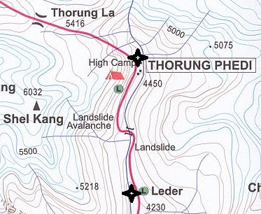
The map I used for visualizing this post can be found as whole over here. I only found it after our trip, but I think it's better than any of the maps we had with us, showing the smaller villages etc. Don't let the various ways of spelling the names of the villages confuse you.

The map I used for visualizing this post can be found as whole over here. I only found it after our trip, but I think it's better than any of the maps we had with us, showing the smaller villages etc. Don't let the various ways of spelling the names of the villages confuse you.

Kommentit
Lähetä kommentti
Kerro.